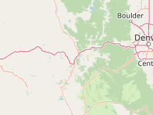
Please Select a Nearby Airport or Weather StationHere is a list of the nearby weather stations showing what historical data we have available for them. The available report types are color coded like so:
Copper Mountain, Red Cliff Pass; United States
28°F, overcast, light snow @ 1:35 AM (13 min ago)
Lake County Airport, United States
26°F, overcast, light snow, mist, precipitation: 0.00 in @ 1:30 AM (18 min ago)
Kremmling, Mc Elroy Airfield; United States
36°F, overcast @ 1:35 AM (13 min ago)
Eagle County Regional Airport, United States
38°F, overcast, light rain @ 12:56 AM (52 min ago)
Aspen–Pitkin County Airport, United States
34°F, overcast, precipitation: 0.00 in @ 1:41 AM (7 min ago)
Cottonwood Pass, United States
32°F, overcast @ 1:35 AM (13 min ago)
Boulder Municipal Airport, United States
37°F, overcast, light drizzle @ 1:35 AM (13 min ago)
Rocky Mountain Metropolitan Airport, United States
36°F, overcast @ 1:35 AM (13 min ago)
Vance Brand Airport, United States
41°F, overcast @ 1:35 AM (13 min ago)
Arapahoe County Airport, United States
36°F, overcast, light rain, precipitation: 0.01 in @ 12:53 AM (55 min ago)
METAR ReportsAirport weather stations throughout the world routinely issue METAR weather reports . Such reports are used by pilots, air traffic controllers, meteorologists, climatologists, and other researchers. They are published via radio transmission and on the internet. We have been collecting and archiving published METAR reports since 2011, and have found third-party sources for archived reports from years prior to that. ISD ReportsThe Integrated Surface Database (ISD), maintained and published by NOAA's National Center for Environmental Information , consists of hourly and synoptic weather reports from a variety of sources. We use ISD data to complement and backfill for our METAR archive. |