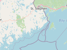
Please Select a Nearby Airport or Weather StationHere is a list of the nearby weather stations showing what historical data we have available for them. The available report types are color coded like so:
Hancock County-Bar Harbor Airport, United States
43°F, clear @ 10:56 PM (50 min ago)
Point Lepreau, N. B.; Canada
31°F @ 12:00 AM (46 min ago)
Brier Island, N. S.; Canada
41°F @ 12:00 AM (46 min ago)
Bangor International Airport, United States
46°F, overcast @ 10:53 PM (53 min ago)
Saint John Airport, Canada
27°F, clear @ 12:00 AM (46 min ago)
88 mi northeast, 1955 - 2024
Yesterday
Millinocket Municipal Airport, United States
49°F, clear @ 10:53 PM (53 min ago)
Yarmouth Airport, Canada
37°F, clear @ 12:00 AM (46 min ago)
Fredericton International Airport, Canada
39°F, clear @ 12:00 AM (46 min ago)
CFB Gagetown, Canada
92 mi northeast, 1975 - 2024
METAR ReportsAirport weather stations throughout the world routinely issue METAR weather reports . Such reports are used by pilots, air traffic controllers, meteorologists, climatologists, and other researchers. They are published via radio transmission and on the internet. We have been collecting and archiving published METAR reports since 2011, and have found third-party sources for archived reports from years prior to that. ISD ReportsThe Integrated Surface Database (ISD), maintained and published by NOAA's National Center for Environmental Information , consists of hourly and synoptic weather reports from a variety of sources. We use ISD data to complement and backfill for our METAR archive. |