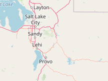
Please Select a Nearby Airport or Weather StationHere is a list of the nearby weather stations showing what historical data we have available for them. The available report types are color coded like so:
Provo Municipal Airport, United States
45°F, overcast, light rain, precipitation: 0.01 in @ 6:12 AM (25 min ago)
Salt Lake City International Airport, United States
47°F, overcast, light rain, precipitation: 0.01 in @ 6:24 AM (13 min ago)
Hill Air Force Base, United States
45°F, overcast, light rain @ 6:28 AM (9 min ago)
Ogden Municipal Airport, United States
48°F, overcast, light rain, precipitation: 0.00 in @ 6:20 AM (17 min ago)
Evanston-Uinta County Burns Field, United States
38°F, overcast, mist @ 6:22 AM (15 min ago)
Carbon County Airport, United States
42°F, overcast, light rain, precipitation: 0.01 in @ 6:19 AM (18 min ago)
Fort Bridger Airport, United States
37°F, partly cloudy @ 6:15 AM (22 min ago)
Logan-Cache Airport, United States
46°F, overcast, precipitation: 0.01 in @ 5:51 AM (46 min ago)
Vernal Regional Airport, United States
44°F, overcast @ 5:53 AM (44 min ago)
METAR ReportsAirport weather stations throughout the world routinely issue METAR weather reports . Such reports are used by pilots, air traffic controllers, meteorologists, climatologists, and other researchers. They are published via radio transmission and on the internet. We have been collecting and archiving published METAR reports since 2011, and have found third-party sources for archived reports from years prior to that. ISD ReportsThe Integrated Surface Database (ISD), maintained and published by NOAA's National Center for Environmental Information , consists of hourly and synoptic weather reports from a variety of sources. We use ISD data to complement and backfill for our METAR archive. |