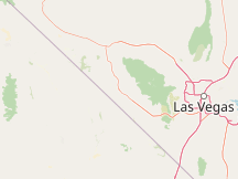
Please Select a Nearby Airport or Weather StationHere is a list of the nearby weather stations showing what historical data we have available for them. The available report types are color coded like so:
Desert Rock Airport, United States
63°F, clear @ 8:53 PM (1 hr, 3 min ago)
Creech Air Force Base, United States
70°F, clear @ 7:55 PM (2 hr, 1 min ago)
North Las Vegas Air Terminal, United States
78°F, clear @ 8:53 PM (1 hr, 3 min ago)
McCarran International Airport, United States
75°F, mostly clear @ 8:56 PM (1 hr, 0 min ago)
Henderson Executive Airport, United States
73°F, clear @ 8:56 PM (1 hr, 0 min ago)
Nellis Air Force Base, United States
77°F, clear @ 8:55 PM (1 hr, 1 min ago)
Boulder City Municipal Airport, United States
72°F, clear @ 9:35 PM (21 min ago)
Bicycle Lake Army Airfield, United States
68°F, clear @ 8:55 PM (1 hr, 1 min ago)
Las Vegas, Tonopah Range #74 Nellis AFB; United States
99 mi north, 2005 - 2014
Laughlin/Bullhead International Airport, United States
77°F, clear @ 9:35 PM (21 min ago)
METAR ReportsAirport weather stations throughout the world routinely issue METAR weather reports . Such reports are used by pilots, air traffic controllers, meteorologists, climatologists, and other researchers. They are published via radio transmission and on the internet. We have been collecting and archiving published METAR reports since 2011, and have found third-party sources for archived reports from years prior to that. ISD ReportsThe Integrated Surface Database (ISD), maintained and published by NOAA's National Center for Environmental Information , consists of hourly and synoptic weather reports from a variety of sources. We use ISD data to complement and backfill for our METAR archive. |