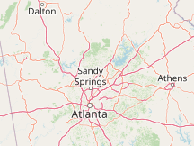
Please Select a Nearby Airport or Weather StationHere is a list of the nearby weather stations showing what historical data we have available for them. The available report types are color coded like so:
Dekalb-Peachtree Airport, United States
72°F, mostly cloudy, precipitation: 0.00 in @ 4:53 PM (32 min ago)
Dobbins Air Reserve Base, United States
76°F, overcast @ 4:55 PM (30 min ago)
Cherokee County Airport, United States
18 mi northwest, 2004 - 2011
Marietta, Cobb County-McCollum Field Airport; United States
76°F, mostly cloudy @ 4:50 PM (35 min ago)
Fulton County Airport-Brown Field, United States
74°F, overcast @ 4:53 PM (32 min ago)
Lee Gilmer Memorial Airport, United States
71°F, partly cloudy @ 4:53 PM (32 min ago)
Hartsfield-Jackson Atlanta International Airport, United States
76°F, mostly cloudy @ 4:52 PM (33 min ago)
Cartersville Airport, United States
77°F, mostly clear @ 5:15 PM (10 min ago)
Barrow County Airport, United States
73°F, overcast @ 5:15 PM (10 min ago)
Paulding Northwest Atlanta Airport, United States
72°F, partly cloudy @ 5:15 PM (10 min ago)
METAR ReportsAirport weather stations throughout the world routinely issue METAR weather reports . Such reports are used by pilots, air traffic controllers, meteorologists, climatologists, and other researchers. They are published via radio transmission and on the internet. We have been collecting and archiving published METAR reports since 2011, and have found third-party sources for archived reports from years prior to that. ISD ReportsThe Integrated Surface Database (ISD), maintained and published by NOAA's National Center for Environmental Information , consists of hourly and synoptic weather reports from a variety of sources. We use ISD data to complement and backfill for our METAR archive. |