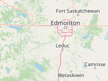
Weather History in Devon CanadaThis page is the jump-off point for all the past weather for Devon. You can get an approximate weather history for Devon via the nearby weather stations listed below. The reports feature all historical weather data series we have available, including the temperature history. You can drill down from year to month and even day level reports by clicking on the graphs. Please Select a Nearby Airport or Weather StationHere is a list of the nearby weather stations showing what historical data we have available for them. The available report types are color coded like so:
Edmonton City Centre Airport, Canada
17 mi northeast, 1950 - 2015
Edmonton Stony Plain Alta., Canada
19 mi northwest, 1982 - 1996
Edmonton/Villeneuve Airport, Canada
21 mi north, 1977 - 1983
Highvale, Canada
31 mi west, 1980 - 2006
Elk Island National Park, Canada
42 mi northeast, 1985 - 1998
Camrose, Canada
45 mi southeast, 1993 - 1998
METAR ReportsAirport weather stations throughout the world routinely issue METAR weather reports . Such reports are used by pilots, air traffic controllers, meteorologists, climatologists, and other researchers. They are published via radio transmission and on the internet. We have been collecting and archiving published METAR reports since 2011, and have found third-party sources for archived reports from years prior to that. ISD ReportsThe Integrated Surface Database (ISD), maintained and published by NOAA's National Center for Environmental Information , consists of hourly and synoptic weather reports from a variety of sources. We use ISD data to complement and backfill for our METAR archive. |