Loading…
December Weather in Boquilla de Babisas (La Boquilla de Conchos) Mexico
Daily high temperatures decrease by 4°F, from 70°F to 66°F, rarely falling below 56°F or exceeding 79°F.
Daily low temperatures decrease by 3°F, from 38°F to 35°F, rarely falling below 26°F or exceeding 47°F.
For reference, on June 14, the hottest day of the year, temperatures in Boquilla de Babisas (La Boquilla de Conchos) typically range from 65°F to 95°F, while on January 6, the coldest day of the year, they range from 35°F to 66°F.
Average High and Low Temperature in December in Boquilla de Babisas (La Boquilla de Conchos)
The figure below shows you a compact characterization of the hourly average temperatures for the quarter of the year centered on December. The horizontal axis is the day, the vertical axis is the hour of the day, and the color is the average temperature for that hour and day.
Average Hourly Temperature in December in Boquilla de Babisas (La Boquilla de Conchos)
Barkly West, Northern Cape, South Africa (9,416 miles away) is the far-away foreign place with temperatures most similar to Boquilla de Babisas (La Boquilla de Conchos) (view comparison).
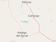

Compare Boquilla de Babisas (La Boquilla de Conchos) to:
Clouds
The month of December in Boquilla de Babisas (La Boquilla de Conchos) experiences essentially constant cloud cover, with the percentage of time that the sky is overcast or mostly cloudy remaining about 39% throughout the month. The highest chance of overcast or mostly cloudy conditions is 41% on December 19.
The clearest day of the month is December 1, with clear, mostly clear, or partly cloudy conditions 63% of the time.
For reference, on August 5, the cloudiest day of the year, the chance of overcast or mostly cloudy conditions is 53%, while on June 3, the clearest day of the year, the chance of clear, mostly clear, or partly cloudy skies is 79%.
Cloud Cover Categories in December in Boquilla de Babisas (La Boquilla de Conchos)
Precipitation
A wet day is one with at least 0.04 inches of liquid or liquid-equivalent precipitation. In Boquilla de Babisas (La Boquilla de Conchos), the chance of a wet day over the course of December is essentially constant, remaining around 5% throughout.
For reference, the year's highest daily chance of a wet day is 36% on August 4, and its lowest chance is 2% on April 3.
Probability of Precipitation in December in Boquilla de Babisas (La Boquilla de Conchos)
Rainfall
To show variation within the month and not just the monthly total, we show the rainfall accumulated over a sliding 31-day period centered around each day.
The average sliding 31-day rainfall during December in Boquilla de Babisas (La Boquilla de Conchos) is essentially constant, remaining about 0.3 inches throughout, and rarely exceeding 1.2 inches or falling below -0.0 inches.
Average Monthly Rainfall in December in Boquilla de Babisas (La Boquilla de Conchos)
Sun
Over the course of December in Boquilla de Babisas (La Boquilla de Conchos), the length of the day is essentially constant. The shortest day of the month is December 21, with 10 hours, 24 minutes of daylight and the longest day is December 1, with 10 hours, 32 minutes of daylight.
Hours of Daylight and Twilight in December in Boquilla de Babisas (La Boquilla de Conchos)
The earliest sunrise of the month in Boquilla de Babisas (La Boquilla de Conchos) is 7:34 AM on December 1 and the latest sunrise is 17 minutes later at 7:51 AM on December 31.
The earliest sunset is 6:06 PM on December 1 and the latest sunset is 11 minutes later at 6:17 PM on December 31.
Daylight saving time is not observed in Boquilla de Babisas (La Boquilla de Conchos) during 2026.
For reference, on June 21, the longest day of the year, the Sun rises at 6:06 AM and sets 13 hours, 53 minutes later, at 8:00 PM, while on December 21, the shortest day of the year, it rises at 7:47 AM and sets 10 hours, 24 minutes later, at 6:11 PM.
Sunrise & Sunset with Twilight in December in Boquilla de Babisas (La Boquilla de Conchos)
The figure below presents a compact representation of the sun's elevation (the angle of the sun above the horizon) and azimuth (its compass bearing) for every hour of every day in the reporting period. The horizontal axis is the day of the year and the vertical axis is the hour of the day. For a given day and hour of that day, the background color indicates the azimuth of the sun at that moment. The black isolines are contours of constant solar elevation.
Solar Elevation and Azimuth in December in Boquilla de Babisas (La Boquilla de Conchos)
Moon
The figure below presents a compact representation of key lunar data for December 2026. The horizontal axis is the day, the vertical axis is the hour of the day, and the colored areas indicate when the moon is above the horizon. The vertical gray bars (new Moons) and blue bars (full Moons) indicate key Moon phases. The label associated with each bar indicates the date and time that the phase is obtained, and the companion time labels indicate the rise and set times of the Moon for the nearest time interval in which the moon is above the horizon.
Moon Rise, Set & Phases in December in Boquilla de Babisas (La Boquilla de Conchos)
| Dec 2026 | Illumination | Moonrise | Moonset | Moonrise | Meridian Passing | Distance | |||||
|---|---|---|---|---|---|---|---|---|---|---|---|
| 1 |
|
50% | 12:48 AM | E | 1:33 PM | W | - | 7:12 AM | S | 235,653 mi | |
| 2 |
|
36% | 1:47 AM | E | 2:04 PM | W | - | 7:57 AM | S | 238,784 mi | |
| 3 |
|
26% | 2:44 AM | E | 2:34 PM | W | - | 8:40 AM | S | 241,684 mi | |
| 4 |
|
17% | 3:41 AM | ESE | 3:06 PM | WSW | - | 9:24 AM | S | 244,274 mi | |
| 5 |
|
10% | 4:38 AM | ESE | 3:40 PM | WSW | - | 10:09 AM | S | 246,525 mi | |
| 6 |
|
5% | 5:35 AM | ESE | 4:18 PM | WSW | - | 10:56 AM | S | 248,431 mi | |
| 7 |
|
2% | 6:33 AM | ESE | 5:00 PM | WSW | - | 11:46 AM | S | 249,995 mi | |
| 8 |
|
0% | 7:29 AM | ESE | 5:46 PM | WSW | - | 12:38 PM | S | 251,211 mi | |
| 9 |
|
1% | 8:23 AM | ESE | 6:37 PM | WSW | - | 1:30 PM | S | 252,059 mi | |
| 10 |
|
3% | 9:12 AM | ESE | 7:31 PM | WSW | - | 2:22 PM | S | 252,492 mi | |
| 11 |
|
7% | 9:56 AM | ESE | 8:27 PM | WSW | - | 3:12 PM | S | 252,448 mi | |
| 12 |
|
13% | 10:36 AM | ESE | 9:22 PM | WSW | - | 3:59 PM | S | 251,852 mi | |
| 13 |
|
20% | 11:11 AM | ESE | 10:17 PM | WSW | - | 4:44 PM | S | 250,638 mi | |
| 14 |
|
29% | 11:42 AM | ESE | 11:11 PM | WSW | - | 5:27 PM | S | 248,758 mi | |
| 15 |
|
38% | 12:12 PM | E | - | - | 6:08 PM | S | 246,202 mi | ||
| 16 |
|
50% | - | 12:05 AM | W | 12:41 PM | E | 6:50 PM | S | 243,017 mi | |
| 17 |
|
59% | - | 1:00 AM | W | 1:11 PM | E | 7:32 PM | S | 239,320 mi | |
| 18 |
|
69% | - | 1:57 AM | W | 1:42 PM | ENE | 8:17 PM | S | 235,304 mi | |
| 19 |
|
79% | - | 2:57 AM | WNW | 2:17 PM | ENE | 9:06 PM | S | 231,246 mi | |
| 20 |
|
88% | - | 4:01 AM | WNW | 2:59 PM | ENE | 10:01 PM | S | 227,491 mi | |
| 21 |
|
95% | - | 5:10 AM | WNW | 3:48 PM | ENE | 11:02 PM | S | 224,415 mi | |
| 22 |
|
97% | - | 6:22 AM | WNW | 4:46 PM | ENE | - | - | ||
| 23 |
|
100% | - | 7:32 AM | WNW | 5:54 PM | ENE | 12:08 AM | N | 222,373 mi | |
| 24 |
|
100% | - | 8:36 AM | WNW | 7:07 PM | ENE | 1:16 AM | S | 221,615 mi | |
| 25 |
|
98% | - | 9:31 AM | WNW | 8:20 PM | ENE | 2:22 AM | S | 222,225 mi | |
| 26 |
|
92% | - | 10:18 AM | WNW | 9:30 PM | ENE | 3:22 AM | S | 224,099 mi | |
| 27 |
|
84% | - | 10:58 AM | WNW | 10:36 PM | E | 4:17 AM | S | 226,982 mi | |
| 28 |
|
75% | - | 11:33 AM | W | 11:38 PM | E | 5:07 AM | S | 230,534 mi | |
| 29 |
|
64% | - | 12:05 PM | W | - | 5:53 AM | S | 234,397 mi | ||
| 30 |
|
50% | 12:38 AM | E | 12:36 PM | W | - | 6:38 AM | S | 238,252 mi | |
| 31 |
|
42% | 1:35 AM | ESE | 1:08 PM | WSW | - | 7:22 AM | S | 241,846 mi | |
Humidity
We base the humidity comfort level on the dew point, as it determines whether perspiration will evaporate from the skin, thereby cooling the body. Lower dew points feel drier and higher dew points feel more humid. Unlike temperature, which typically varies significantly between night and day, dew point tends to change more slowly, so while the temperature may drop at night, a muggy day is typically followed by a muggy night.
The chance that a given day will be muggy in Boquilla de Babisas (La Boquilla de Conchos) is essentially constant during December, remaining around 0% throughout.
For reference, on August 11, the muggiest day of the year, there are muggy conditions 5% of the time, while on January 1, the least muggy day of the year, there are muggy conditions 0% of the time.
Humidity Comfort Levels in December in Boquilla de Babisas (La Boquilla de Conchos)
Wind
This section discusses the wide-area hourly average wind vector (speed and direction) at 10 meters above the ground. The wind experienced at any given location is highly dependent on local topography and other factors, and instantaneous wind speed and direction vary more widely than hourly averages.
The average hourly wind speed in Boquilla de Babisas (La Boquilla de Conchos) is essentially constant during December, remaining within 0.1 miles per hour of 7.6 miles per hour throughout.
For reference, on April 11, the windiest day of the year, the daily average wind speed is 9.8 miles per hour, while on August 15, the calmest day of the year, the daily average wind speed is 6.8 miles per hour.
Average Wind Speed in December in Boquilla de Babisas (La Boquilla de Conchos)
The hourly average wind direction in Boquilla de Babisas (La Boquilla de Conchos) throughout December is predominantly from the west, with a peak proportion of 44% on December 26.
Wind Direction in December in Boquilla de Babisas (La Boquilla de Conchos)
Growing Season
Definitions of the growing season vary throughout the world, but for the purposes of this report, we define it as the longest continuous period of non-freezing temperatures (≥ 32°F) in the year (the calendar year in the Northern Hemisphere, or from July 1 until June 30 in the Southern Hemisphere).
The growing season in Boquilla de Babisas (La Boquilla de Conchos) typically lasts for 9.0 months (272 days), from around February 24 to around November 23, rarely starting before January 30 or after March 22, and rarely ending before October 29 or after December 17.
The month of December in Boquilla de Babisas (La Boquilla de Conchos) is more likely than not fully outside of the growing season, with the chance that a given day is in the growing season rapidly decreasing from 34% to 3% over the course of the month.
Time Spent in Various Temperature Bands and the Growing Season in December in Boquilla de Babisas (La Boquilla de Conchos)
Growing degree days are a measure of yearly heat accumulation used to predict plant and animal development, and defined as the integral of warmth above a base temperature, discarding any excess above a maximum temperature. In this report, we use a base of 50°F and a cap of 86°F.
The average accumulated growing degree days in Boquilla de Babisas (La Boquilla de Conchos) are gradually increasing during December, increasing by 162°F, from 6,084°F to 6,246°F, over the course of the month.
Growing Degree Days in December in Boquilla de Babisas (La Boquilla de Conchos)
Solar Energy
This section discusses the total daily incident shortwave solar energy reaching the surface of the ground over a wide area, taking full account of seasonal variations in the length of the day, the elevation of the Sun above the horizon, and absorption by clouds and other atmospheric constituents. Shortwave radiation includes visible light and ultraviolet radiation.
The average daily incident shortwave solar energy in Boquilla de Babisas (La Boquilla de Conchos) is essentially constant during December, remaining within 0.1 kWh of 4.0 kWh throughout.
The lowest average daily incident shortwave solar energy during December is 3.9 kWh on December 19.
Average Daily Incident Shortwave Solar Energy in December in Boquilla de Babisas (La Boquilla de Conchos)
Topography
For the purposes of this report, the geographical coordinates of Boquilla de Babisas (La Boquilla de Conchos) are 27.549 deg latitude, -105.404 deg longitude, and 4,180 ft elevation.
The topography within 2 miles of Boquilla de Babisas (La Boquilla de Conchos) contains significant variations in elevation, with a maximum elevation change of 709 feet and an average elevation above sea level of 4,267 feet. Within 10 miles contains significant variations in elevation (1,703 feet). Within 50 miles contains very significant variations in elevation (3,947 feet).
The area within 2 miles of Boquilla de Babisas (La Boquilla de Conchos) is covered by shrubs (70%) and water (26%), within 10 miles by shrubs (84%) and water (11%), and within 50 miles by shrubs (70%) and grassland (25%).
Data Sources
This report illustrates the typical weather in Boquilla de Babisas (La Boquilla de Conchos), based on a statistical analysis of historical hourly weather reports and model reconstructions from January 1, 1980 to December 31, 2016.
Temperature and Dew Point
There is only a single weather station, General Roberto Fierro Villalobos International Airport, in our network suitable to be used as a proxy for the historical temperature and dew point records of Boquilla de Babisas (La Boquilla de Conchos).
At a distance of 140 kilometers from Boquilla de Babisas (La Boquilla de Conchos), closer than our threshold of 150 kilometers, this station is deemed sufficiently nearby to be relied upon as our primary source for temperature and dew point records.
The station records are corrected for the elevation difference between the station and Boquilla de Babisas (La Boquilla de Conchos) according to the International Standard Atmosphere , and by the relative change present in the MERRA-2 satellite-era reanalysis between the two locations.
Please note that the station records themselves may additionally have been back-filled using other nearby stations or the MERRA-2 reanalysis.
Other Data
All data relating to the Sun's position (e.g., sunrise and sunset) are computed using astronomical formulas from the book, Astronomical Algorithms 2nd Edition , by Jean Meeus.
All other weather data, including cloud cover, precipitation, wind speed and direction, and solar flux, come from NASA's MERRA-2 Modern-Era Retrospective Analysis . This reanalysis combines a variety of wide-area measurements in a state-of-the-art global meteorological model to reconstruct the hourly history of weather throughout the world on a 50-kilometer grid.
Land Use data comes from the Global Land Cover SHARE database , published by the Food and Agriculture Organization of the United Nations.
Elevation data comes from the Shuttle Radar Topography Mission (SRTM) , published by NASA's Jet Propulsion Laboratory.
Names, locations, and time zones of places and some airports come from the GeoNames Geographical Database .
Time zones for airports and weather stations are provided by AskGeo.com .
Maps are © OpenStreetMap contributors.
Disclaimer
The information on this site is provided as is, without any assurances as to its accuracy or suitability for any purpose. Weather data is prone to errors, outages, and other defects. We assume no responsibility for any decisions made on the basis of the content presented on this site.
We draw particular cautious attention to our reliance on the MERRA-2 model-based reconstructions for a number of important data series. While having the tremendous advantages of temporal and spatial completeness, these reconstructions: (1) are based on computer models that may have model-based errors, (2) are coarsely sampled on a 50 km grid and are therefore unable to reconstruct the local variations of many microclimates, and (3) have particular difficulty with the weather in some coastal areas, especially small islands.
We further caution that our travel scores are only as good as the data that underpin them, that weather conditions at any given location and time are unpredictable and variable, and that the definition of the scores reflects a particular set of preferences that may not agree with those of any particular reader.
Please review our full terms contained on our Terms of Service page.

You're permitted to use this graph as long as you provide prominent attribution with a link back close to the use of the graph. For example: © WeatherSpark.com
For print usage, please acquire a license.