Winter 1995 Weather History at San Luis Obispo County Airport California, United States

This report shows the past weather for San Luis Obispo County Airport, providing a weather history for the winter of 1995. It features all historical weather data series we have available, including the San Luis Obispo County Airport temperature history for the winter of 1995. You can drill down from year to month and even day level reports by clicking on the graphs.

San Luis Obispo County Airport Temperature History in the Winter of 1995

Temperature history in the Winter of 1995 at San Luis Obispo County AirportDecJanFeb30°F30°F40°F40°F50°F50°F60°F60°F70°F70°F80°F80°F90°F90°FFallSpring
The daily range of reported temperatures (gray bars) and 24-hour highs (red ticks) and lows (blue ticks), placed over the daily average high (faint red line) and low (faint blue line) temperature, with 25th to 75th and 10th to 90th percentile bands.

Hourly Temperature in the Winter of 1995 at San Luis Obispo County Airport

Hourly Temperature in the Winter of 1995 at San Luis Obispo County AirportDecJanFeb12 AM12 AM3 AM3 AM6 AM6 AM9 AM9 AM12 PM12 PM3 PM3 PM6 PM6 PM9 PM9 PM12 AM12 AMFallSpringcoldcool
frigid 15°F freezing 32°F very cold 45°F cold 55°F cool 65°F comfortable 75°F warm 85°F hot 95°F sweltering
The hourly reported temperature, color coded into bands. The shaded overlays indicate night and civil twilight.
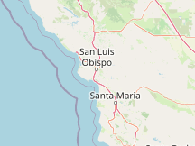
Map
Marker
© OpenStreetMap contributors

Compare San Luis Obispo County Airport to:

Cloud Cover in the Winter of 1995 at San Luis Obispo County Airport

Cloud Cover in the Winter of 1995 at San Luis Obispo County AirportDecJanFeb12 AM12 AM3 AM3 AM6 AM6 AM9 AM9 AM12 PM12 PM3 PM3 PM6 PM6 PM9 PM9 PM12 AM12 AMFallSpring
0% clear 20% mostly clear 40% partly cloudy 60% mostly cloudy 80% overcast 100%
no significant cloudno cloud detectedceiling and visibility ok
The hourly reported cloud coverage, categorized by the percentage of the sky covered by clouds.

Observed Weather in the Winter of 1995 at San Luis Obispo County Airport

Observed Weather in the Winter of 1995 at San Luis Obispo County AirportDecJanFeb12 AM12 AM3 AM3 AM6 AM6 AM9 AM9 AM12 PM12 PM3 PM3 PM6 PM6 PM9 PM9 PM12 AM12 AMFallSpring
foghazedrizzlelight rainmoderate rainheavy rainfreezing rainsleetsnow grainslight snowmoderate snowheavy snowhailthunderstorm
The hourly observed weather, color coded by category (in order of severity). If multiple reports are present, the most severe code is shown.
DayObservationsPrecipitationCodes
Fri, Dec 1 Fog, Sky-Obscuring FogFG, IWC45
Sat, Dec 2 FogFG
Sun, Dec 3 Fog, Sky-Obscuring FogFG, IWC45
Mon, Dec 4 Fog, Sky-Obscuring FogFG, IWC45
Wed, Dec 6 Fog, Sky-Obscuring FogFG, IWC45
Sat, Dec 9 Fog, Sky-Obscuring FogFG, IWC45
Sun, Dec 10 Fog, Sky-Obscuring FogFG, IWC45
Mon, Dec 11 Light Rain, Drizzle, Haze, Fog, Sky-Obscuring Fog-RA, IWC61, DZ, IWC53, IWC05, FG, IWC45
Tue, Dec 12 Thunderstorm with Rain, Rain, Showers of Rain, Light Rain, Showers of Light Rain, FogTSRA, RA, SHRA, -RA, -SHRA, FG
Wed, Dec 13 Thunderstorm with Rain, Rain, Showers of Rain, Light Drizzle, Fog, Sky-Obscuring FogTSRA, IWC95, RA, IWC63, IWC81, -DZ, IWC51, FG, IWC45
Fri, Dec 15 Showers of Rain, DrizzleSHRA, IWC81, DZ, IWC53
Tue, Dec 19 Fog, Sky-Obscuring FogFG, IWC45
Fri, Dec 22 Rain, Drizzle, Fog, Sky-Obscuring FogRA, IWC63, DZ, IWC53, FG, IWC45
Mon, Dec 25 Light Rain-RA, IWC61
Fri, Dec 29 Fog, Sky-Obscuring FogFG, IWC45
Sat, Dec 30 FogFG
Sun, Dec 31 Fog, Sky-Obscuring FogFG, IWC45
Wed, Jan 3 Fog, Sky-Obscuring FogFG, IWC45
Mon, Jan 8 Fog, Sky-Obscuring FogFG, IWC45
Tue, Jan 9 Fog, Sky-Obscuring FogFG, IWC45
Sat, Jan 13 Drizzle with Fog, Haze, Fog, Sky-Obscuring FogFGDZ, IWC05, FG, IWC45
Sun, Jan 14 Drizzle, Drizzle with Fog, Haze, Fog, Sky-Obscuring FogDZ, FGDZ, IWC05, FG, IWC45
Mon, Jan 15 Fog, Sky-Obscuring FogFG, IWC45
Tue, Jan 16 Light Rain, Drizzle, Light Drizzle, Fog-RA, DZ, -DZ, FG
Thu, Jan 18 Rain, Light Rain, Drizzle, Fog, Sky-Obscuring FogRA, IWC63, -RA, IWC61, DZ, IWC53, FG, IWC45
Fri, Jan 19 Fog, Sky-Obscuring FogFG, IWC45
Sun, Jan 21 Rain, Light Rain, Fog, Sky-Obscuring FogRA, IWC63, -RA, IWC61, FG, IWC45
Wed, Jan 24 Drizzle, Light Drizzle, Fog, Sky-Obscuring FogDZ, IWC53, -DZ, IWC51, FG, IWC45
Thu, Jan 25 Light Rain, Light Drizzle, Fog, Sky-Obscuring Fog-RA, IWC61, -DZ, IWC51, FG, IWC45
Sat, Jan 27 Light Rain, Drizzle, Light Drizzle, Fog, Sky-Obscuring Fog-RA, IWC61, DZ, IWC53, -DZ, IWC51, FG, IWC45
Tue, Jan 30 Rain, Showers of Light RainRA, IWC63, -SHRA, IWC80
Wed, Jan 31 Rain, Light Rain, Drizzle, Light Drizzle, Fog, Sky-Obscuring FogRA, IWC63, -RA, IWC61, DZ, IWC53, -DZ, IWC51, FG, IWC45
Thu, Feb 1 Fog, Sky-Obscuring FogFG, IWC45
Fri, Feb 2 Fog, Sky-Obscuring FogFG, IWC45
Sat, Feb 3 Rain, Showers of Rain, Light Rain, Drizzle, Light Drizzle, Fog, Sky-Obscuring FogRA, IWC63, SHRA, IWC81, -RA, IWC61, DZ, IWC53, -DZ, IWC51, FG, IWC45
Sun, Feb 4 Rain, Light Rain, Showers of Light Rain, Drizzle, Fog, Sky-Obscuring FogRA, IWC63, -RA, IWC61, -SHRA, IWC80, DZ, IWC53, FG, IWC45
Mon, Feb 5 Thunderstorm with Rain, Rain, Light Rain, Drizzle, Fog, Sky-Obscuring FogTSRA, IWC95, RA, IWC63, -RA, IWC61, DZ, IWC53, FG, IWC45
Fri, Feb 9 Fog, Sky-Obscuring FogFG, IWC45
Sun, Feb 11 Drizzle with Fog, Haze, Fog, Sky-Obscuring FogFGDZ, IWC05, FG, IWC45
Wed, Feb 14 Fog, Sky-Obscuring FogFG, IWC45
Thu, Feb 15 Rain, Fog, Sky-Obscuring FogRA, IWC63, FG, IWC45
Fri, Feb 16 Light Drizzle, Fog, Sky-Obscuring Fog-DZ, IWC51, FG, IWC45
Sat, Feb 17 Drizzle, Light Drizzle, Fog, Sky-Obscuring FogDZ, IWC53, -DZ, IWC51, FG, IWC45
Sun, Feb 18 Rain, Light Rain, Drizzle with Fog, Haze, Fog, Sky-Obscuring FogRA, IWC63, -RA, IWC61, FGDZ, IWC05, FG, IWC45
Mon, Feb 19 Rain, Showers of Rain, Light Rain, Showers of Light Rain, Fog, Sky-Obscuring FogRA, IWC63, SHRA, IWC81, -RA, IWC61, -SHRA, IWC80, FG, IWC45
Tue, Feb 20 Rain, Light Rain, Drizzle, Fog, Sky-Obscuring FogRA, IWC63, -RA, IWC61, DZ, IWC53, FG, IWC45
Wed, Feb 21 Showers of Rain, Light Rain, Showers of Light Rain, Fog, Sky-Obscuring FogSHRA, IWC81, -RA, IWC61, -SHRA, IWC80, FG, IWC45
Thu, Feb 22 Light Rain-RA, IWC61
Sun, Feb 25 Light Rain-RA, IWC61
Tue, Feb 27 Rain, Light RainRA, IWC63, -RA, IWC61
Wed, Feb 28 Light Drizzle-DZ, IWC51
Thu, Feb 29 Rain, Showers of Rain, Light Rain, Drizzle, Fog, Sky-Obscuring FogRA, IWC63, SHRA, IWC81, -RA, IWC61, DZ, IWC53, FG, IWC45

Hours of Daylight and Twilight in the Winter of 1995 at San Luis Obispo County Airport

Hours of Daylight and Twilight in the Winter of 1995 at San Luis Obispo County AirportDecJanFeb0 hr24 hr4 hr20 hr8 hr16 hr12 hr12 hr16 hr8 hr20 hr4 hr24 hr0 hrFallSpringDec 229 hr, 47 minDec 229 hr, 47 minnightnightdaydayFeb 2911 hr, 25 minFeb 2911 hr, 25 min
The number of hours during which the Sun is visible (black line). From bottom (most yellow) to top (most gray), the color bands indicate: full daylight, twilight (civil, nautical, and astronomical), and full night.

Sunrise & Sunset with Twilight in the Winter of 1995 at San Luis Obispo County Airport

Sunrise & Sunset with Twilight in the Winter of 1995 at San Luis Obispo County AirportDecJanFeb12 AM12 AM2 AM2 AM4 AM4 AM6 AM6 AM8 AM8 AM10 AM10 AM12 PM12 PM2 PM2 PM4 PM4 PM6 PM6 PM8 PM8 PM10 PM10 PM12 AM12 AMFallSpring6:32 AM6:32 AMFeb 295:57 PMFeb 295:57 PM6:56 AM6:56 AMDec 54:50 PMDec 54:50 PM7:11 AM7:11 AMJan 75:05 PMJan 75:05 PM
The solar day over the course of the Winter of 1995. From bottom to top, the black lines are the previous solar midnight, sunrise, solar noon, sunset, and the next solar midnight. The day, twilights (civil, nautical, and astronomical), and night are indicated by the color bands from yellow to gray.

Solar Elevation and Azimuth in the Winter of 1995 at San Luis Obispo County Airport

Solar Elevation and Azimuth in the Winter of 1995 at San Luis Obispo County AirportDecJanFeb12 AM12 AM2 AM2 AM4 AM4 AM6 AM6 AM8 AM8 AM10 AM10 AM12 PM12 PM2 PM2 PM4 PM4 PM6 PM6 PM8 PM8 PM10 PM10 PM12 AM12 AMFallSpring0010202030305000101020303040
northeastsouthwest
Solar elevation and azimuth in the the winter of 1995. The black lines are lines of constant solar elevation (the angle of the sun above the horizon, in degrees). The background color fills indicate the azimuth (the compass bearing) of the sun. The lightly tinted areas at the boundaries of the cardinal compass points indicate the implied intermediate directions (northeast, southeast, southwest, and northwest).

Moon Rise, Set & Phases in the Winter of 1995 at San Luis Obispo County Airport

Moon Rise, Set & Phases in the Winter of 1995 at San Luis Obispo County AirportDecJanFeb12 AM12 AM4 AM4 AM8 AM8 AM12 PM12 PM4 PM4 PM8 PM8 PM12 AM12 AMFallSpringNov 611:21 PMNov 611:21 PMNov 227:43 AMNov 227:43 AMDec 65:28 PMDec 65:28 PMDec 216:23 PMDec 216:23 PMJan 512:52 PMJan 512:52 PMJan 204:51 AMJan 204:51 AMFeb 47:58 AMFeb 47:58 AMFeb 183:31 PMFeb 183:31 PMMar 51:23 AMMar 51:23 AMMar 192:45 AMMar 192:45 AM4:55 PM4:55 PM6:47 AM6:47 AM4:59 PM4:59 PM7:18 AM7:18 AM5:01 PM5:01 PM7:28 AM7:28 AM5:03 PM5:03 PM6:43 AM6:43 AM5:42 PM5:42 PM6:25 AM6:25 AM6:52 PM6:52 PM
The time in which the moon is above the horizon (light blue area), with new moons (dark gray lines) and full moons (blue lines) indicated. The shaded overlays indicate night and civil twilight.

Humidity Comfort Levels in the Winter of 1995 at San Luis Obispo County Airport

Humidity Comfort Levels in the Winter of 1995 at San Luis Obispo County AirportDecJanFeb12 AM12 AM3 AM3 AM6 AM6 AM9 AM9 AM12 PM12 PM3 PM3 PM6 PM6 PM9 PM9 PM12 AM12 AMFallSpring
dry 55°F comfortable 60°F humid 65°F muggy 70°F oppressive 75°F miserable
The hourly reported humidity comfort level, categorized by dew point. The shaded overlays indicate night and civil twilight.

Wind Speed in the Winter of 1995 at San Luis Obispo County Airport

Wind Speed in the Winter of 1995 at San Luis Obispo County AirportDecJanFeb0 mph0 mph10 mph10 mph20 mph20 mph30 mph30 mph40 mph40 mphFallSpring
The daily range of reported wind speeds (gray bars), with maximum gust speeds (red ticks).

Hourly Wind Speed in the Winter of 1995 at San Luis Obispo County Airport

Hourly Wind Speed in the Winter of 1995 at San Luis Obispo County AirportDecJanFeb12 AM12 AM3 AM3 AM6 AM6 AM9 AM9 AM12 PM12 PM3 PM3 PM6 PM6 PM9 PM9 PM12 AM12 AMFallSpring
0 mph calm 1 mph light air 4 mph light breeze 8 mph gentle breeze 13 mph moderate breeze 18 mph fresh breeze 25 mph strong breeze 31 mph near gale 39 mph gale 47 mph strong gale 55 mph storm 64 mph violent storm 73 mph hurricane force
The hourly reported wind speed, color coded into bands according to the Beaufort scale. The shaded overlays indicate night and civil twilight.
Growing degree days are a measure of yearly heat accumulation used to predict plant and animal development, and defined as the integral of warmth above a base temperature, discarding any excess above a maximum temperature. In this report, we use a base of 50°F and a cap of 86°F.

Growing Degree Days in the Winter of 1995 at San Luis Obispo County Airport

Growing Degree Days in the Winter of 1995 at San Luis Obispo County AirportDecJanFeb500°F500°F1,000°F1,000°F1,500°F1,500°F2,000°F2,000°F2,500°F2,500°F3,000°F3,000°F3,500°F3,500°F4,000°F4,000°FFallSpring
The growing degree days accumulated from reported temperatures over the course of the winter (solid black line), placed over the average accumulation (faint line), with 25th to 75th and 10th to 90th percentile bands. Gaps indicate days without enough temperature reports to calculate a complete daily value; totals following gaps may therefore be understated.

Hourly Wind Direction in 1995 at San Luis Obispo County Airport

Hourly Wind Direction in 1995 at San Luis Obispo County AirportDecJanFeb12 AM12 AM3 AM3 AM6 AM6 AM9 AM9 AM12 PM12 PM3 PM3 PM6 PM6 PM9 PM9 PM12 AM12 AMFallSpring
calmnortheastsouthwest
The hourly reported wind direction, color coded by compass point. The shaded overlays indicate night and civil twilight.

Atmospheric Pressure in the Winter of 1995 at San Luis Obispo County Airport

Atmospheric Pressure in the Winter of 1995 at San Luis Obispo County AirportDecJanFeb29.6 inHg29.6 inHg29.8 inHg29.8 inHg30.0 inHg30.0 inHg30.2 inHg30.2 inHg30.4 inHg30.4 inHgFallSpring
The daily range of atmospheric pressure (gray bars), as measured by the altimeter setting reported in e.g. a METAR report.

Number of Reports by Day in the Winter of 1995 at San Luis Obispo County Airport 1995

Number of Reports by Day in the Winter of 1995 at San Luis Obispo County AirportDecJanFeb0024244848FallSpring
regularspecialcorrection
The number of reports per day.

Reports by Hour in the Winter of 1995 at San Luis Obispo County Airport 1995

Reports by Hour in the Winter of 1995 at San Luis Obispo County AirportDecJanFeb12 AM12 AM3 AM3 AM6 AM6 AM9 AM9 AM12 PM12 PM3 PM3 PM6 PM6 PM9 PM9 PM12 AM12 AMFallSpring
regularspecialcorrection
Indication of what types of reports were recorded during each hour.

This report graphically illustrates the historical weather reports recorded by the weather station at San Luis Obispo County Airport in the winter of 1995.

METAR Reports

Airport weather stations throughout the world routinely issue METAR weather reports . Such reports are used by pilots, air traffic controllers, meteorologists, climatologists, and other researchers. They are published via radio transmission and on the internet. We have been collecting and archiving published METAR reports since 2011, and have found third-party sources for archived reports from years prior to that.

ISD Reports

The Integrated Surface Database (ISD), maintained and published by NOAA's National Center for Environmental Information , consists of hourly and synoptic weather reports from a variety of sources. We use ISD data to complement and backfill for our METAR archive.

Other Data

The sources for the averages shown in the daily temperature chart are discussed in greater detail on this station's Averages Report.

All data relating to the Sun's position (e.g., sunrise and sunset) are computed using astronomical formulas from the book, Astronomical Algorithms 2nd Edition , by Jean Meeus.

Names, locations, and time zones of places and some airports come from the GeoNames Geographical Database .

Time zones for airports and weather stations are provided by AskGeo.com .

Maps are © OpenStreetMap contributors.

Disclaimer

The information on this site is provided as is, without any assurances as to its accuracy or suitability for any purpose. Weather data is prone to errors, outages, and other defects. We assume no responsibility for any decisions made on the basis of the content presented on this site.

We draw particular cautious attention to our reliance on the MERRA-2 model-based reconstructions for a number of important data series. While having the tremendous advantages of temporal and spatial completeness, these reconstructions: (1) are based on computer models that may have model-based errors, (2) are coarsely sampled on a 50 km grid and are therefore unable to reconstruct the local variations of many microclimates, and (3) have particular difficulty with the weather in some coastal areas, especially small islands.

We further caution that our travel scores are only as good as the data that underpin them, that weather conditions at any given location and time are unpredictable and variable, and that the definition of the scores reflects a particular set of preferences that may not agree with those of any particular reader.

Please review our full terms contained on our Terms of Service page.