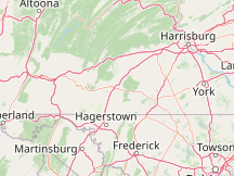
Weather History in Guilford United StatesThis page is the jump-off point for all the past weather for Guilford. You can get an approximate weather history for Guilford via the nearby weather stations listed below. The reports feature all historical weather data series we have available, including the temperature history. You can drill down from year to month and even day level reports by clicking on the graphs. Please Select a Nearby Airport or Weather StationHere is a list of the nearby weather stations showing what historical data we have available for them. The available report types are color coded like so:
Fort Ritchie, United States
59°F, partly cloudy @ 12:12 AM (43 min ago)
15 mi southeast, 2005 - 2024
Yesterday
Hagerstown Regional Airport, United States
64°F, overcast @ 11:53 PM (1 hr, 2 min ago)
16 mi southwest, 1973 - 2024
Yesterday
Frederick Municipal Airport, United States
partly cloudy @ 12:55 AM (0 min ago)
37 mi south, 1948 - 2024
Yesterday
Carroll County Regional Airport/Jack B Poage Field, United States
63°F, mostly cloudy @ 12:40 AM (15 min ago)
York Airport, United States
59°F, overcast, precipitation: 0.00 in @ 12:36 AM (19 min ago)
39 mi east, 2016 - 2024
Yesterday
Eastern West Virginia Regional Airport, United States
65°F, overcast @ 11:53 PM (1 hr, 2 min ago)
41 mi southwest, 1949 - 2024
Yesterday
Capital City Airport, United States
58°F, overcast, light rain, mist, precipitation: 0.08 in @ 12:41 AM (14 min ago)
45 mi northeast, 2016 - 2024
Yesterday
Altoona-Blair County Airport, United States
57°F, overcast, light rain @ 12:25 AM (30 min ago)
46 mi northwest, 1949 - 2024
Yesterday
Harrisburg International Airport, United States
56°F, overcast, light rain, mist, precipitation: 0.07 in @ 12:43 AM (12 min ago)
48 mi northeast, 2016 - 2024
Yesterday
Montgomery County Airpark, United States
61°F, overcast @ 12:38 AM (17 min ago)
57 mi southeast, 2007 - 2024
Yesterday
METAR ReportsAirport weather stations throughout the world routinely issue METAR weather reports . Such reports are used by pilots, air traffic controllers, meteorologists, climatologists, and other researchers. They are published via radio transmission and on the internet. We have been collecting and archiving published METAR reports since 2011, and have found third-party sources for archived reports from years prior to that. ISD ReportsThe Integrated Surface Database (ISD), maintained and published by NOAA's National Center for Environmental Information , consists of hourly and synoptic weather reports from a variety of sources. We use ISD data to complement and backfill for our METAR archive. |