Loading…
March 2026 Weather History in Anniston
The data for this report comes from the Anniston Metropolitan Airport. See all nearby weather stations
This report shows the past weather for Anniston, providing a weather history for March 2026. It features all historical weather data series we have available, including the Anniston temperature history for March 2026. You can drill down from year to month and even day level reports by clicking on the graphs.
Anniston Temperature History March 2026
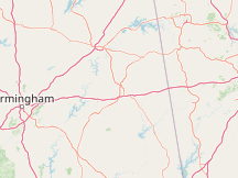

Compare Anniston to:
Observed Weather in March 2026 in Anniston
| Day | Observations | Precipitation | Codes |
|---|---|---|---|
| Thu, Mar 5 | Haze | HZ | |
| Fri, Mar 6 | Mist | 0.00 in | BR |
| Sat, Mar 7 | Thunderstorm with Heavy Rain, Light Rain, Mist | 0.19 in | +TSRA, -RA, BR |
| Sun, Mar 8 | Rain, Light Rain, Fog, Mist | 0.17 in | RA, -RA, FG, BR |
| Mon, Mar 9 | Thunderstorm in the Vicinity, Thunderstorm with Heavy Rain, Thunderstorm with Light Rain, Thunderstorm with Rain, Heavy Rain, Rain, Light Rain, Fog, Mist | 1.38 in | VCTS, +TSRA, -TSRA, TSRA, +RA, RA, -RA, FG, BR |
| Tue, Mar 10 | Light Rain, Mist | 0.06 in | -RA, BR |
| Wed, Mar 11 | Light Rain | 0.00 in | -RA |
| Thu, Mar 12 | Thunderstorm in the Vicinity, Thunderstorm with Heavy Rain, Heavy Rain, Rain, Light Rain, Mist | 1.20 in | VCTS, +TSRA, +RA, RA, -RA, BR |
| Mon, Mar 16 | Thunderstorm in the Vicinity, Thunderstorm with Heavy Rain, Light Snow, Heavy Rain, Rain, Light Rain, Mist, Unknown Precipitation | 0.81 in | VCTS, +TSRA, -SN, +RA, RA, -RA, BR, UP |
| Fri, Mar 20 | Haze, Mist | HZ, BR | |
| Sun, Mar 22 | Mist | BR | |
| Tue, Mar 24 | Haze | HZ | |
| Fri, Mar 27 | Mist | BR |
Hours of Daylight and Twilight in March 2026 in Anniston
Sunrise & Sunset with Twilight and Daylight Saving Time in March 2026 in Anniston
Solar Elevation and Azimuth in March 2026 in Anniston
Moon Rise, Set & Phases in March 2026 in Anniston
| Mar 2026 | Illumination | Moonrise | Moonset | Moonrise | Meridian Passing | Distance | |||||
|---|---|---|---|---|---|---|---|---|---|---|---|
| 1 |
|
98% | - | 5:11 AM | WNW | 3:59 PM | ENE | 10:55 PM | S | 234,893 mi | |
| 2 |
|
100% | - | 5:43 AM | WNW | 5:05 PM | ENE | 11:41 PM | S | 237,148 mi | |
| 3 |
|
100% | - | 6:12 AM | W | 6:08 PM | E | - | - | ||
| 4 |
|
99% | - | 6:38 AM | W | 7:09 PM | E | 12:25 AM | S | 239,710 mi | |
| 5 |
|
96% | - | 7:04 AM | W | 8:09 PM | ESE | 1:08 AM | S | 242,422 mi | |
| 6 |
|
92% | - | 7:30 AM | WSW | 9:09 PM | ESE | 1:50 AM | S | 245,090 mi | |
| 7 |
|
85% | - | 7:59 AM | WSW | 10:09 PM | ESE | 2:34 AM | S | 247,502 mi | |
| 8 |
|
77% | - | 9:30 AM | WSW | - | 4:00 AM | S | 249,427 mi | ||
| 9 |
|
68% | 12:08 AM | ESE | 10:06 AM | WSW | - | 5:07 AM | S | 250,750 mi | |
| 10 |
|
59% | 1:07 AM | ESE | 10:47 AM | WSW | - | 5:57 AM | S | 251,268 mi | |
| 11 |
|
50% | 2:03 AM | SE | 11:35 AM | SW | - | 6:49 AM | S | 250,928 mi | |
| 12 |
|
40% | 2:55 AM | SE | 12:29 PM | SW | - | 7:42 AM | S | 249,725 mi | |
| 13 |
|
30% | 3:42 AM | ESE | 1:27 PM | WSW | - | 8:35 AM | S | 247,733 mi | |
| 14 |
|
21% | 4:24 AM | ESE | 2:29 PM | WSW | - | 9:27 AM | S | 245,096 mi | |
| 15 |
|
13% | 5:00 AM | ESE | 3:33 PM | WSW | - | 10:16 AM | S | 242,023 mi | |
| 16 |
|
7% | 5:32 AM | ESE | 4:37 PM | WSW | - | 11:04 AM | S | 238,764 mi | |
| 17 |
|
2% | 6:01 AM | E | 5:41 PM | W | - | 11:50 AM | S | 235,590 mi | |
| 18 |
|
0% | 6:29 AM | E | 6:46 PM | W | - | 12:36 PM | S | 232,758 mi | |
| 19 |
|
1% | 6:57 AM | E | 7:53 PM | W | - | 1:23 PM | S | 230,485 mi | |
| 20 |
|
4% | 7:27 AM | ENE | 9:02 PM | WNW | - | 2:11 PM | S | 228,911 mi | |
| 21 |
|
10% | 8:00 AM | ENE | 10:14 PM | WNW | - | 3:03 PM | S | 228,093 mi | |
| 22 |
|
19% | 8:39 AM | ENE | 11:28 PM | WNW | - | 4:00 PM | S | 228,001 mi | |
| 23 |
|
29% | 9:25 AM | ENE | - | - | 5:00 PM | S | 228,539 mi | ||
| 24 |
|
40% | - | 12:40 AM | WNW | 10:19 AM | NE | 6:02 PM | S | 229,576 mi | |
| 25 |
|
50% | - | 1:46 AM | NW | 11:22 AM | NE | 7:05 PM | S | 230,974 mi | |
| 26 |
|
64% | - | 2:44 AM | WNW | 12:30 PM | ENE | 8:04 PM | S | 232,616 mi | |
| 27 |
|
74% | - | 3:32 AM | WNW | 1:40 PM | ENE | 8:59 PM | S | 234,425 mi | |
| 28 |
|
84% | - | 4:11 AM | WNW | 2:48 PM | ENE | 9:50 PM | S | 236,358 mi | |
| 29 |
|
91% | - | 4:45 AM | WNW | 3:54 PM | ENE | 10:37 PM | S | 238,395 mi | |
| 30 |
|
96% | - | 5:14 AM | W | 4:56 PM | E | 11:20 PM | S | 240,519 mi | |
| 31 |
|
98% | - | 5:40 AM | W | 5:57 PM | E | - | - | ||
Wind Speed in March 2026 in Anniston
Hourly Wind Speed in March 2026 in Anniston
Growing Degree Days in March 2026 in Anniston
Data Sources
The details of the data sources used for this report can be found on the Anniston Metropolitan Airport page.
See all nearby weather stations
Disclaimer
The information on this site is provided as is, without any assurances as to its accuracy or suitability for any purpose. Weather data is prone to errors, outages, and other defects. We assume no responsibility for any decisions made on the basis of the content presented on this site.
We draw particular cautious attention to our reliance on the MERRA-2 model-based reconstructions for a number of important data series. While having the tremendous advantages of temporal and spatial completeness, these reconstructions: (1) are based on computer models that may have model-based errors, (2) are coarsely sampled on a 50 km grid and are therefore unable to reconstruct the local variations of many microclimates, and (3) have particular difficulty with the weather in some coastal areas, especially small islands.
We further caution that our travel scores are only as good as the data that underpin them, that weather conditions at any given location and time are unpredictable and variable, and that the definition of the scores reflects a particular set of preferences that may not agree with those of any particular reader.
Please review our full terms contained on our Terms of Service page.

You're permitted to use this graph as long as you provide prominent attribution with a link back close to the use of the graph. For example: © WeatherSpark.com
For print usage, please acquire a license.