Loading…
November 2024 Weather History at Charles B. Wheeler Downtown Airport
This report shows the past weather for Charles B. Wheeler Downtown Airport, providing a weather history for November 2024. It features all historical weather data series we have available, including the Charles B. Wheeler Downtown Airport temperature history for November 2024. You can drill down from year to month and even day level reports by clicking on the graphs.
Charles B. Wheeler Downtown Airport Temperature History November 2024
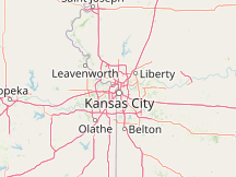

Compare Charles B. Wheeler Downtown Airport to:
Cloud Cover in November 2024 at Charles B. Wheeler Downtown Airport
Observed Weather in November 2024 at Charles B. Wheeler Downtown Airport
| Day | Observations | Precipitation | Codes |
|---|---|---|---|
| Sat, Nov 2 | Heavy Rain, Light Rain, Mist | 0.23 in | +RA, -RA, BR |
| Sun, Nov 3 | Heavy Rain, Rain, Light Rain, Mist | 0.98 in | +RA, RA, -RA, BR |
| Mon, Nov 4 | Rain, Light Rain, Mist | 0.25 in | RA, -RA, BR |
| Tue, Nov 5 | Light Rain, Mist | 0.00 in | -RA, BR |
| Wed, Nov 6 | Fog, Mist | FG, BR | |
| Thu, Nov 7 | Mist | BR | |
| Sat, Nov 9 | Rain, Light Rain, Mist | 0.39 in | RA, -RA, BR |
| Wed, Nov 13 | Rain, Light Rain, Mist | 0.70 in | RA, -RA, BR |
| Mon, Nov 18 | Heavy Rain, Rain, Light Rain, Mist | 1.04 in | +RA, RA, -RA, BR |
| Wed, Nov 27 | Rain, Light Rain, Mist | 0.21 in | RA, -RA, BR |
| Sat, Nov 30 | Heavy Snow, Snow, Light Snow, Freezing Fog, Mist | 0.26 in | +SN, SN, -SN, FZFG, BR |
Hours of Daylight and Twilight in November 2024 at Charles B. Wheeler Downtown Airport
Sunrise & Sunset with Twilight and Daylight Saving Time in November 2024 at Charles B. Wheeler Downtown Airport
Solar Elevation and Azimuth in November 2024 at Charles B. Wheeler Downtown Airport
Moon Rise, Set & Phases in November 2024 at Charles B. Wheeler Downtown Airport
| Nov 2024 | Illumination | Moonrise | Moonset | Moonrise | Meridian Passing | Distance | |||||
|---|---|---|---|---|---|---|---|---|---|---|---|
| 1 |
|
0% | 7:57 AM | ESE | 6:10 PM | WSW | - | 1:04 PM | S | 250,691 mi | |
| 2 |
|
2% | 9:00 AM | ESE | 6:40 PM | WSW | - | 1:50 PM | S | 249,361 mi | |
| 3 |
|
5% | 9:04 AM | ESE | 6:16 PM | SW | - | 1:40 PM | S | 247,705 mi | |
| 4 |
|
10% | 10:07 AM | SE | 7:01 PM | SW | - | 2:34 PM | S | 245,730 mi | |
| 5 |
|
18% | 11:06 AM | SE | 7:56 PM | SW | - | 3:31 PM | S | 243,436 mi | |
| 6 |
|
26% | 11:58 AM | SE | 8:58 PM | SW | - | 4:28 PM | S | 240,836 mi | |
| 7 |
|
36% | 12:42 PM | ESE | 10:07 PM | WSW | - | 5:24 PM | S | 237,969 mi | |
| 8 |
|
50% | 1:19 PM | ESE | 11:18 PM | WSW | - | 6:18 PM | S | 234,922 mi | |
| 9 |
|
59% | 1:50 PM | ESE | - | - | 7:10 PM | S | 231,841 mi | ||
| 10 |
|
70% | - | 12:31 AM | WSW | 2:17 PM | ESE | 7:59 PM | S | 228,930 mi | |
| 11 |
|
81% | - | 1:44 AM | W | 2:43 PM | E | 8:48 PM | S | 226,443 mi | |
| 12 |
|
89% | - | 2:57 AM | W | 3:08 PM | E | 9:37 PM | S | 224,652 mi | |
| 13 |
|
96% | - | 4:12 AM | W | 3:35 PM | ENE | 10:28 PM | S | 223,803 mi | |
| 14 |
|
99% | - | 5:30 AM | WNW | 4:05 PM | ENE | 11:22 PM | S | 224,066 mi | |
| 15 |
|
100% | - | 6:50 AM | WNW | 4:42 PM | ENE | - | - | ||
| 16 |
|
100% | - | 8:10 AM | WNW | 5:26 PM | NE | 12:21 AM | S | 225,487 mi | |
| 17 |
|
97% | - | 9:25 AM | NW | 6:21 PM | NE | 1:23 AM | S | 227,970 mi | |
| 18 |
|
92% | - | 10:30 AM | NW | 7:24 PM | NE | 2:25 AM | S | 231,278 mi | |
| 19 |
|
84% | - | 11:23 AM | NW | 8:32 PM | NE | 3:26 AM | S | 235,081 mi | |
| 20 |
|
76% | - | 12:05 PM | WNW | 9:40 PM | ENE | 4:22 AM | S | 239,017 mi | |
| 21 |
|
66% | - | 12:38 PM | WNW | 10:47 PM | ENE | 5:14 AM | S | 242,755 mi | |
| 22 |
|
50% | - | 1:05 PM | WNW | 11:50 PM | ENE | 6:00 AM | S | 246,027 mi | |
| 23 |
|
46% | - | 1:27 PM | WNW | - | 6:42 AM | S | 248,646 mi | ||
| 24 |
|
36% | 12:51 AM | E | 1:48 PM | W | - | 7:22 AM | S | 250,502 mi | |
| 25 |
|
27% | 1:49 AM | E | 2:07 PM | W | - | 8:00 AM | S | 251,560 mi | |
| 26 |
|
19% | 2:48 AM | E | 2:27 PM | W | - | 8:39 AM | S | 251,847 mi | |
| 27 |
|
12% | 3:47 AM | ESE | 2:49 PM | WSW | - | 9:18 AM | S | 251,439 mi | |
| 28 |
|
6% | 4:47 AM | ESE | 3:13 PM | WSW | - | 10:00 AM | S | 250,448 mi | |
| 29 |
|
2% | 5:50 AM | ESE | 3:41 PM | WSW | - | 10:45 AM | S | 249,003 mi | |
| 30 |
|
0% | 6:54 AM | ESE | 4:16 PM | WSW | - | 11:35 AM | S | 247,234 mi | |
Wind Speed in November 2024 at Charles B. Wheeler Downtown Airport
Hourly Wind Speed in November 2024 at Charles B. Wheeler Downtown Airport
Growing Degree Days in November 2024 at Charles B. Wheeler Downtown Airport
Reports by Month
Number of Reports by Day in November 2024 at Charles B. Wheeler Downtown Airport
Reports by Hour in November 2024 at Charles B. Wheeler Downtown Airport
Data Sources
This report graphically illustrates the historical weather reports recorded by the weather station at Charles B. Wheeler Downtown Airport in November 2024.
METAR Reports
Airport weather stations throughout the world routinely issue METAR weather reports . Such reports are used by pilots, air traffic controllers, meteorologists, climatologists, and other researchers. They are published via radio transmission and on the internet. We have been collecting and archiving published METAR reports since 2011, and have found third-party sources for archived reports from years prior to that.
ISD Reports
The Integrated Surface Database (ISD), maintained and published by NOAA's National Center for Environmental Information , consists of hourly and synoptic weather reports from a variety of sources. We use ISD data to complement and backfill for our METAR archive.
Other Data
The sources for the averages shown in the daily temperature chart are discussed in greater detail on this station's Averages Report.
All data relating to the Sun's position (e.g., sunrise and sunset) are computed using astronomical formulas from the book, Astronomical Algorithms 2nd Edition , by Jean Meeus.
Names, locations, and time zones of places and some airports come from the GeoNames Geographical Database .
Time zones for airports and weather stations are provided by AskGeo.com .
Maps are © OpenStreetMap contributors.
Disclaimer
The information on this site is provided as is, without any assurances as to its accuracy or suitability for any purpose. Weather data is prone to errors, outages, and other defects. We assume no responsibility for any decisions made on the basis of the content presented on this site.
We draw particular cautious attention to our reliance on the MERRA-2 model-based reconstructions for a number of important data series. While having the tremendous advantages of temporal and spatial completeness, these reconstructions: (1) are based on computer models that may have model-based errors, (2) are coarsely sampled on a 50 km grid and are therefore unable to reconstruct the local variations of many microclimates, and (3) have particular difficulty with the weather in some coastal areas, especially small islands.
We further caution that our travel scores are only as good as the data that underpin them, that weather conditions at any given location and time are unpredictable and variable, and that the definition of the scores reflects a particular set of preferences that may not agree with those of any particular reader.
Please review our full terms contained on our Terms of Service page.

You're permitted to use this graph as long as you provide prominent attribution with a link back close to the use of the graph. For example: © WeatherSpark.com
For print usage, please acquire a license.